Iceland InSAR Analysis
Analysis & Modelling Coursework • Fagradalsfjall Eruption Study
Abstract
Fagradalsfjall on the Reykjanes Peninsula exhibited intense seismic activity before its 2021 eruption. Using Sentinel‑1 InSAR data, wrapped interferograms, DInSAR processing, DEM correction, and LOS displacement conversion were applied to detect volcanic deformation. Results showed strong subsidence of −0.066 m near Grindavík.
Introduction
Iceland lies along the Mid‑Atlantic Ridge, where tectonic plates diverge and volcanic systems remain highly active. The 2021 Fagradalsfjall eruption marked the reawakening of a volcanic system dormant for nearly 800 years. InSAR provides precise measurements of uplift and subsidence, enabling researchers to understand magma movement.
Methodology
Two Sentinel‑1B SAR images captured before and after the eruption were used for analysis. These images were precisely aligned to ensure pixel‑level accuracy. An interferogram was generated by subtracting the phase values of the two acquisitions, revealing fringe patterns that represent ground deformation. A Goldstein filter reduced noise and improved clarity. A Digital Elevation Model removed topographic effects, isolating volcanic deformation. The wrapped phase was converted into continuous displacement values through phase unwrapping, and finally transformed into line‑of‑sight displacement to produce a detailed deformation map.
Scientific Visuals
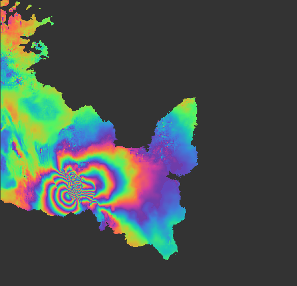
Wrapped Interferogram
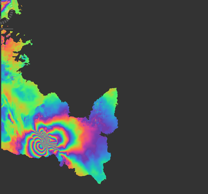
Unwrapped Phase Map
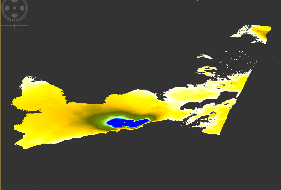
LOS Displacement Map
Results
The LOS displacement map revealed strong subsidence of −0.066 m near Grindavík, confirming magma withdrawal beneath the surface. High coherence across the Reykjanes Peninsula allowed clear identification of deformation patterns.